7 wonders of Kazakhstan
Quite often we want to run away to the end of the world to get away from troubles and urban fuss. To swim along the blue horizon, to bury our feet in hot sand, throwing our heads back, to go and have time to get acquainted with the world. For some reason, it always seems possible only somewhere far from home, because everything here is familiar and well known.
Nevertheless, the PHOTOSAFARI group will never agree with this concept. A group of talented photographers and videographers is traveling around Kazakhstan and exploring it for several years in a row.They are sure that still there is something to see where you can escape from your routine and find your inspiration.
Together we made a list of seven wonderful places scattered across the map of the uninhabited Kazakhstan, which you can visit and have the time of your life.
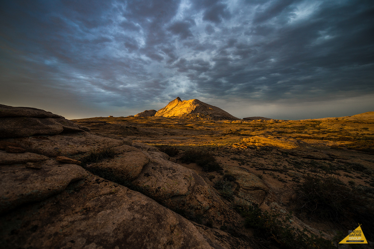
1. Bektau-Ata tract (Central Kazakhstan)
Coordinates: 47 ° 27'10 «с.ш. 74 ° 46'59» в.д.
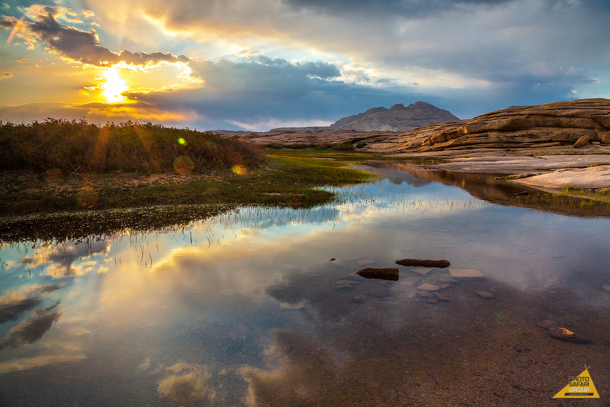
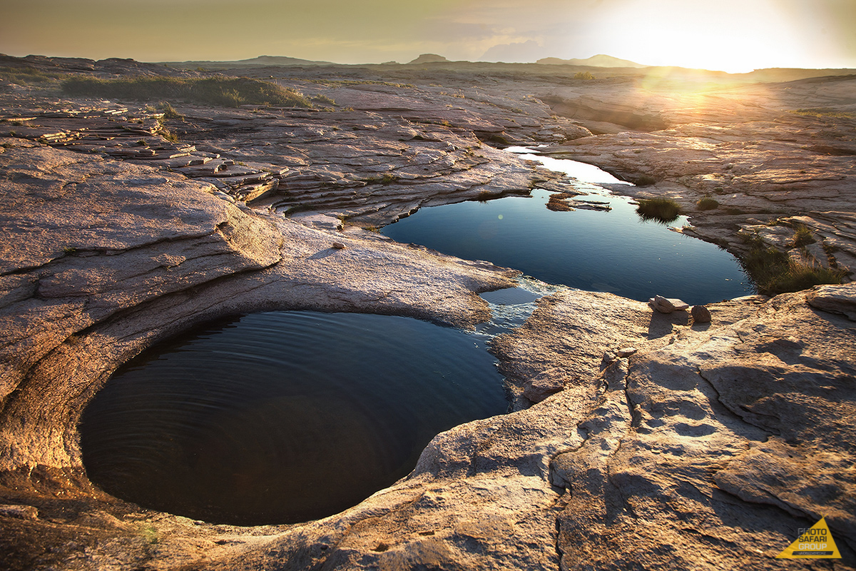
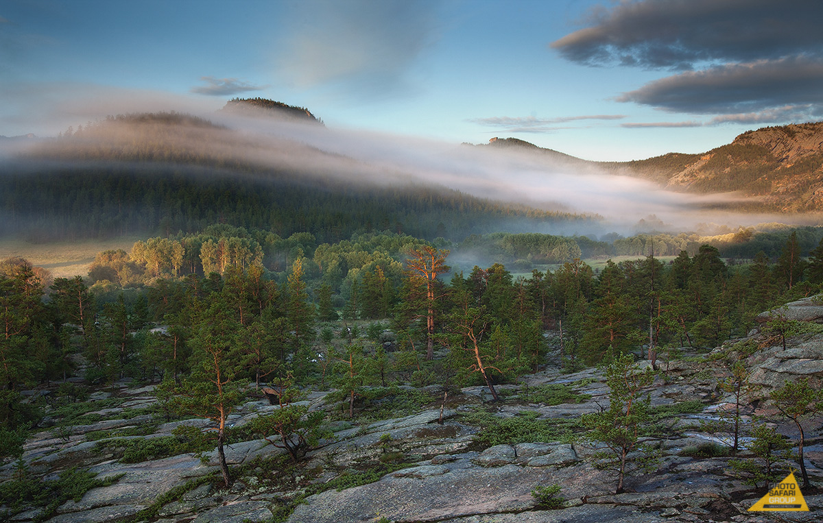
This amazing place of northern Balkhash has a Martian-like volcanic origin. An unusual rock mass appeared as a result of melting of mountain formations during the genesis of the volcano, which never exploded.
In addition to capricious stone forms, here you can find rare species of plants. In the spring in the lowlands tracts are covered with deciduous groves and thorn bushes, but closer to summer the relief gets full of sweet fragrant steppe grass.
On the south-western slope of the range, one can find the cave with spring water, called «Auliye». According to the legends, this healing spring helps women coming to pray for desirable but yet not happened motherhood.
During the day, the shadows in the stone corridors of Bektau-Ata follow sun's movement by changing the image of rocky massif on the hourly basis.
How to get there:
By car: on the «Almaty-Balkhash-Karaganda» highway, between 60 and 70 kilometers from the Balkhash city, turn at the «Бектау-Ата, 12 км » sign. You can already observe the complex from the road.
The locality is almost untouched by man. However, there is one recreational center and camp for children, the later one is not hosting tourists.
Camping in tents is allowed. But make sure to have enough drinking water. Despite presence of springs, you might spend quite a time to reach and find them. However there is always enough water for technical purposes.
By the way, if you cannot travel by car, you can come by bus from Karaganda bus station by the route to Balkhash.
2. Shaitankol (Central Kazakhstan)
Coordinates: 49°23'48.6″N 75°23'36.5″E
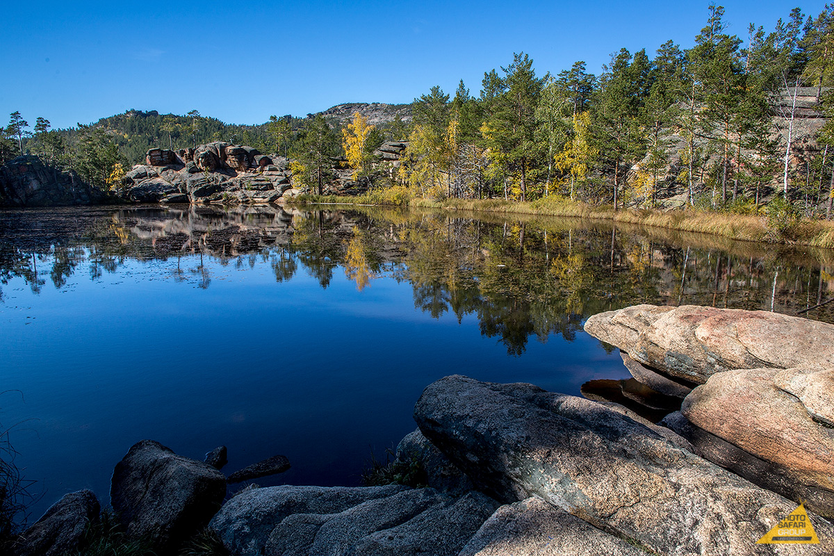
Mysterious lake Shaitankol is located five kilometers from Karkaralinsk, at 1,200 meters above the sea level. Its black waters are surrounded by rocks with odorous pinewood on the top of them.
The lake was called devilish by locals because of the «devilry» that has always been accompanying this place: sometimes people disappear by the lakeside, sometimes the whole herd. According to the one of local legends, bishop Mikhail tried to sanctify the lake in the beginning of the last century. After sanctification people installed the cross on the western shore of the lake which disappeared in half of the year.
Local folktales formed the basis for the poem of Sabit Mukanov «Sulushash». The poem tells the story of two lovers who escaped for the sake of their love. Also, the description of this picturesque lake can be found in the Michael Prishvin's «Steppe Sketch».
The Karkaralinsk itself has been positively transformed in the recent years: new sidewalks appeared, the building in which Russian traveler and geographer Potanin lived was renovated, as well as the wooden house where Abay Kunanbayev was staying.
How to get there:
It is convenient to get to Karkaralinsk by car through the M-36 highway, since roads are quite fine. Also, you can get to Karaganda by train and when already the city switch to the taxi or bus till Karkaralinsk. Shaitankol is located five kilometers to the west of Karkaralinsk which is around 5 hours on foot.
There are a lot of recreational houses. For instance «Shakhtyor» where the route till Devil's Lake starts from. Camping in tents is allowed but not everyone is brave enough to go for it, since at the nighttime «devils are becoming naughty» by the lake.
3. Boszhira Tract (Western Kazakhstan)
Coordinates: 43°25'1″N 54°4'27″E
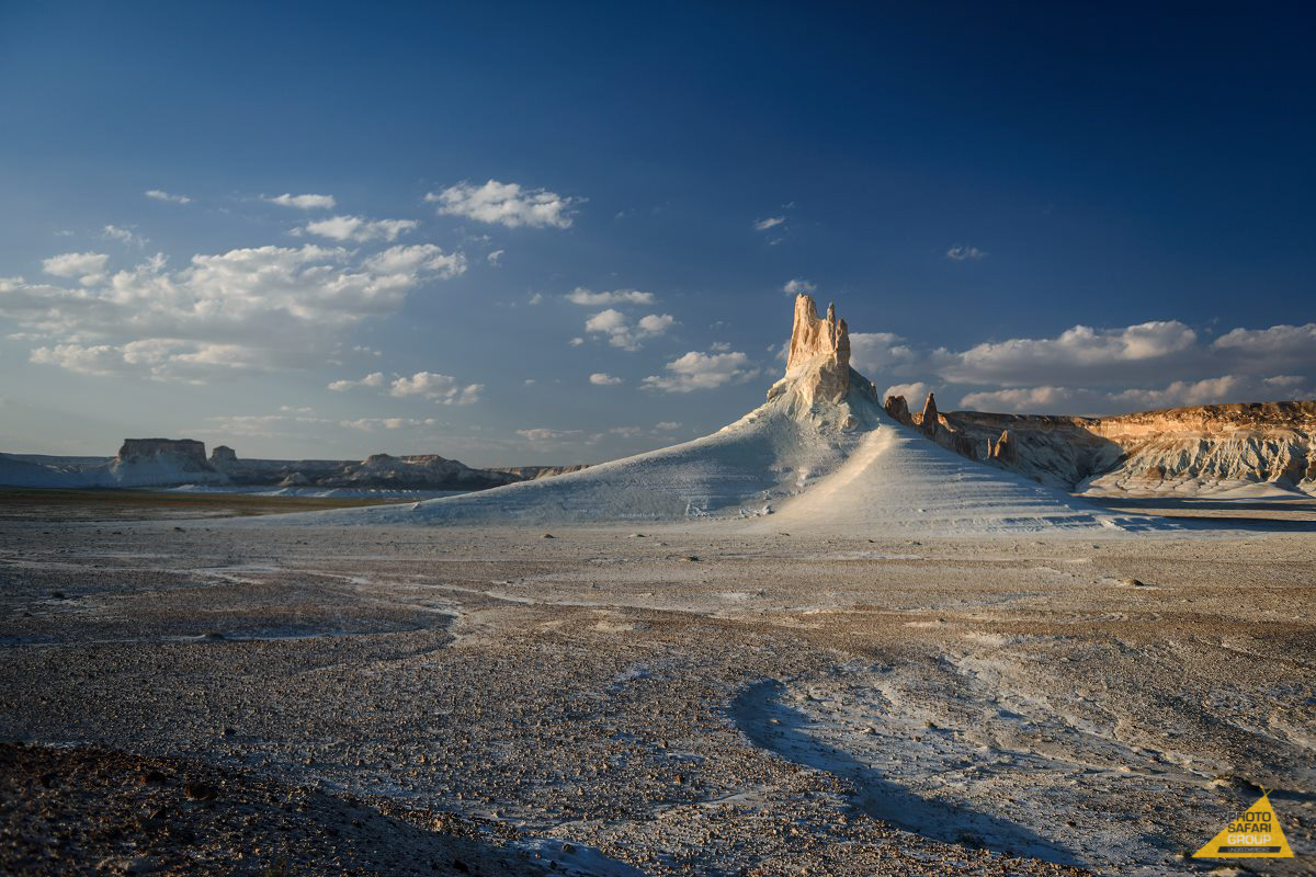
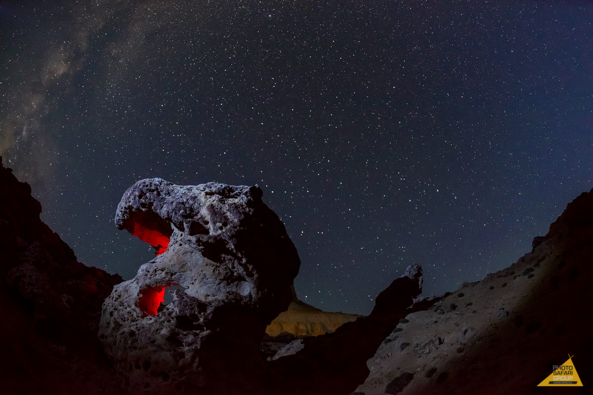
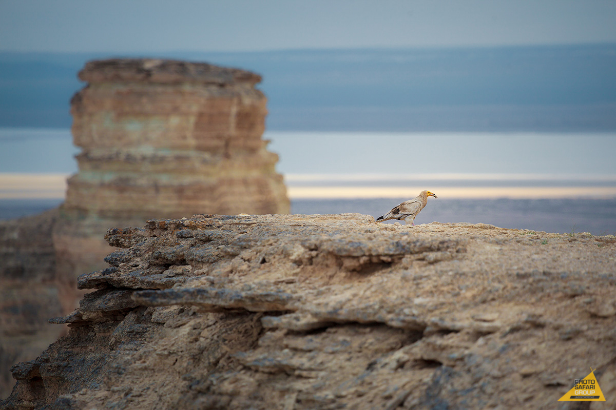
Snow-white flatland of Boszhira Tract with sharp rocky peaks shining in the sunlight is both an outlandish place and the business card of the Usturt plateau. Hundreds of millions years ago this place formed the bottom of Tethys, ancient impetuous ocean of Mesozoic era.
Unusual landscape has formed as a result of gradual change of the ocean's water level. White stones, accurately carved by the time, and sea fossils are scattered throughout the valley.
On the top of the plateau one can easily notice stony installations made of limestone plates. These are remains of hunting corrals — arans. They were used for hunting of various ungulate inhabitants of steppe till up to 30s of the last century. Today this ensemble is not more than a monument of the old days.
How to get there:
The Boszhyra Tract is located on the Mangyshlak peninsula in the western part of the Usturt plateau, 298 kilometers from Aktau city. Zhanaozen is the closest city, from there is it 60 kilometers of desert till the plateau.
Due to the underdeveloped infrastructure the way to the Usturt plateau is quite complicated. Therefore it is hard to get to the Boszhyra valley on your own. Far easier way is to hire a guide, who will explain the route or even will stay close during the whole trip. Plan the trip in the dry period of the year, when the soil dries out, otherwise the route is quite dangerous. Camping in tents is not prohibited but keep in mind that local wind is very harsh, unpredictable and causing sandstorms.
4. Charyn Canyon (South Kazakhstan)
Coordinates: 43° 20.793'N 78° 55.698'E
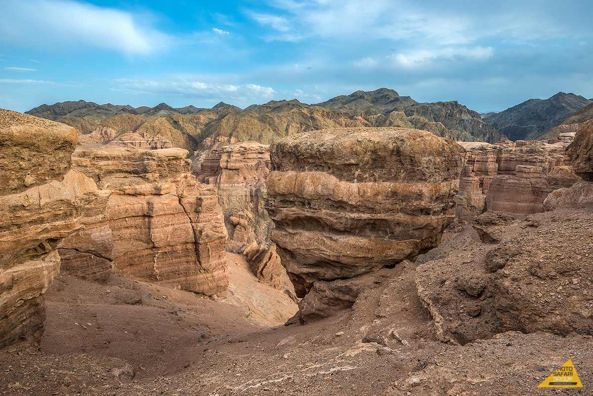


Are there anyone from Almaty who has never been to the Charyn Canyon yet? This huge stone labyrinth attracts hundreds of tourists annually and every time shocks with its scale since its length is reaching 154 kilometers, while the height of steep mountains is reaching 300 meters.
Here you can walk on the «Valley of Castles» and see the chain of red indents similar to towers of giants. Some guides like to tell fairytales about witches attacking belated tourists in the «valley». Sitting by the fire, you can hear howling and «laughter of coven»since the wind, hitting the porous rock cliffs, creates mystical sounds.
Also, take a look at relict ash grove which has been through the era of glaciation. Another similar grove can be found only in the North America.
How to get there:
The canyon is located on the east from the Almaty city, close to the Chinese border. You can get there by car from the city through the Kuldjinskiy tract. Firstly, after going 110 kilometers on crossroad, turn to the right nearby Chilik settlement. Next turn is on the next crossroad, where the road goes to the left to Chundji and to the right to Charyn Canyon. When you reach the Koklek settlement, in approximately 25 kilometers afterwards turn on the sign » Чарынский каньон».
Cars should be left on the top of the canyon. If you plan to stay overnight, you can either camp in tents or stay in yurts available for tourists starting from this year.
5. Lake Kaindy (South Kazakhstan)
Coordinates: 42°59'3″N 78°27'55″E
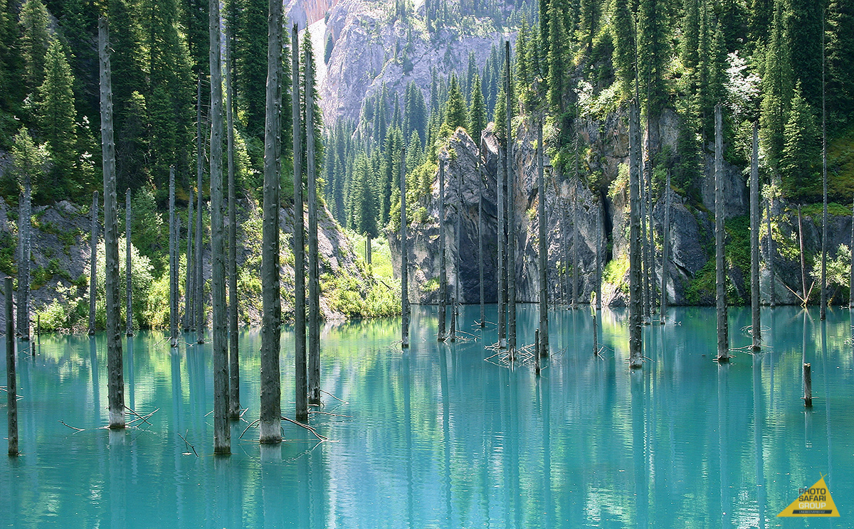
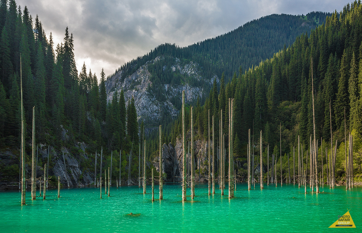
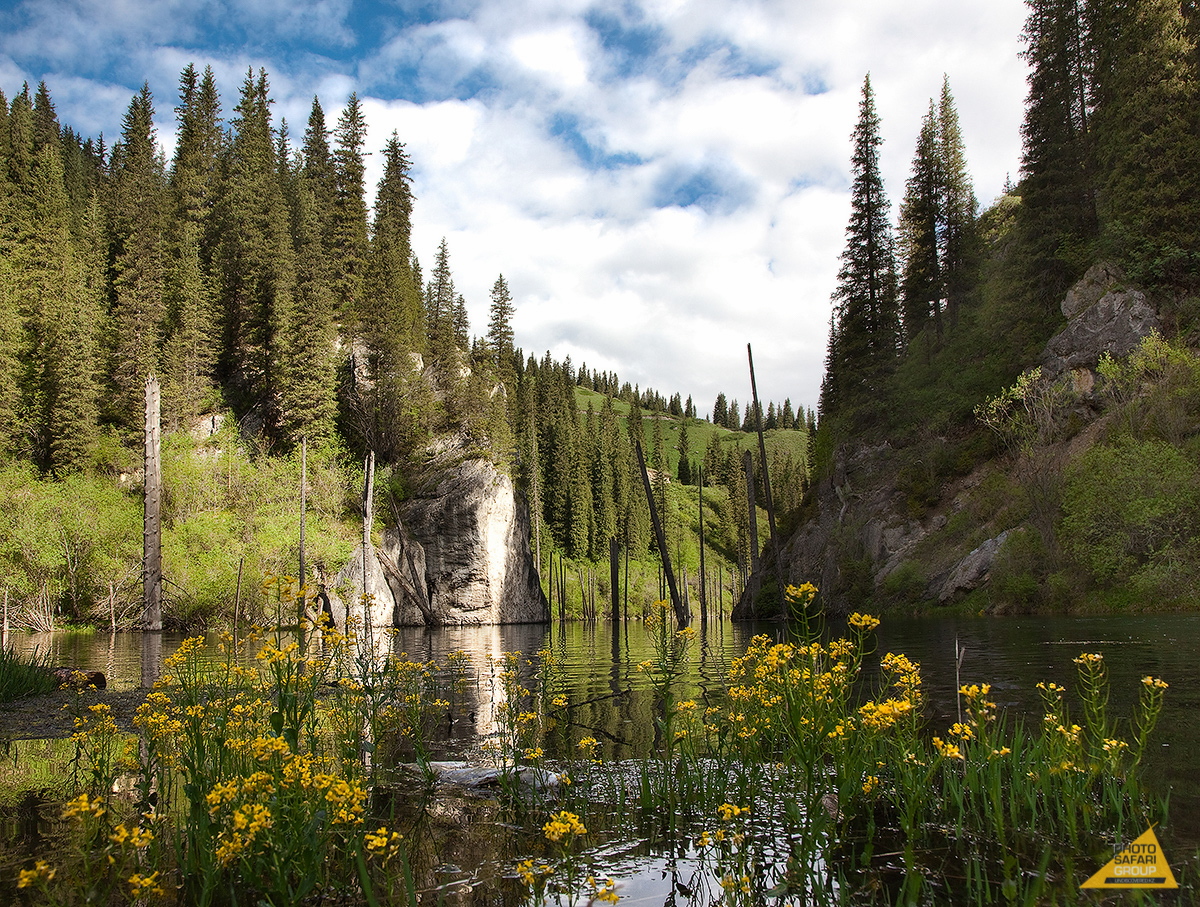
In the Kungey Alatau pass, close to the famous Kolsay lake, the marvelous lake of Kaindy is located. Naked tree stems are rising above turquoise water surface, which fully covers flooded wood.
Few people know that the lake appeared here only about 100 years ago when mudflow has blocked the valley and the tall Tien-Shan spruces found themselves under water.
In translation from Kazakh language «Kaindy» means «birch». The lake was called birchen because of the birchen grove located in five kilometers from the lake.
By the way, it is the case when you have to hurry up in order to personally enjoy the local landscapes, since the nature has already threatened the lake with several recent attacks. Another mudflow сame down here in 1980, repeating the old-day events. As a result, the waterlevel has decreased and the lake became muddy.
Of course with time the mud has settled on the bottom and the lake returned its crystal appearance, however, the feeling that these stately trees are in the expectation of something scary will never leave us.
How to get there:
In this particular case, it is more convenient to use ready tour, the price of which contains not only the Kaindy excursion, but also the overnight stay at a guest house in Saty settlement, breakfast, dinner and excursion to the Kolsay lakes.
In case you are travelling by own car, the way to the lake is going through the Zhalanash settlement to the east of Almaty city. 800 meters before reaching the Saty village, turn to the left on the country road which goes up sharply. Only SUVs are capable of reaching the lake.
The barrier has been set at the entrance to the lake because the lake is located on the territory of the forestry enterprise. To pass through it, you should pay the fee for the car, tent and each of the persons.
6. Singing Barkhan (South Kazakhstan)
Coordinates: 43°51'53″N 78°34'00″E
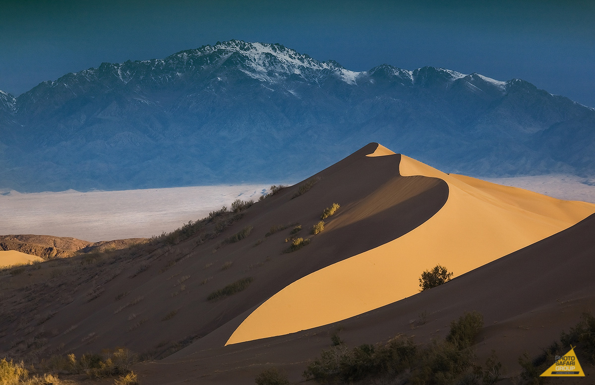
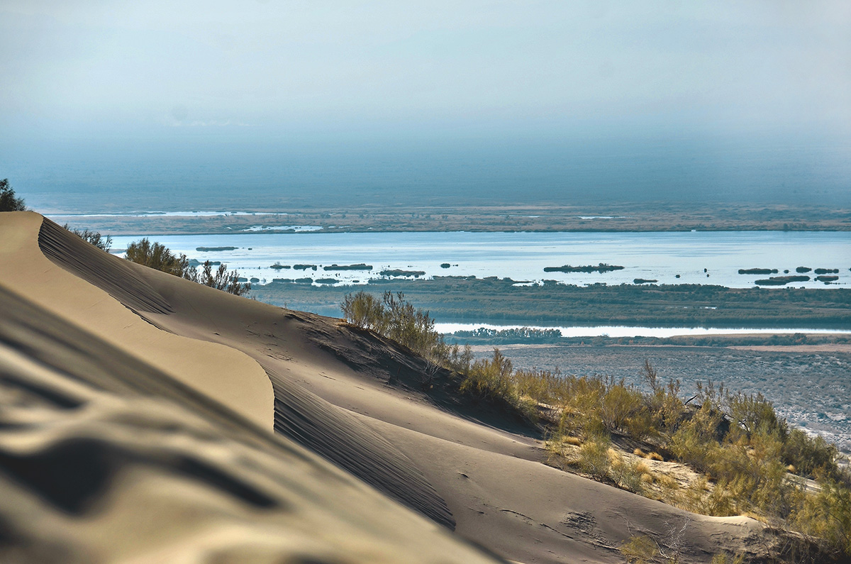
Singing Barkhan is a 150 meters high dune made of fine yellow sand. You can observe it frim far away, and even hear it on a hot dry day. Unique sound resembling the organ music was the reason for the title «singing» in the name of the dune.
People could not reach the common opinion concerning why the sand mountain is «singing», but it does not really matter when you make the huge dune to buzz under your steps.
You can sandboard here. Just take your board if you have been planning to try it for a long while.
While in the national park, don't forget to touch the famous 700-years-old willow, which can be found on the road to the Aktau mountains. People say that this ancient tree has witnessed Genghis Khan's military campaign.
How to get there:
The Altyn Yemel can be reached by own car on the road through Saryozek, but don't turn to Kugaly. After, you go till the Basshy settlement, the location of the central farmstead of the national park. The way will take five hours.
Upon arrival you must pay fees for the car and for each of the persons. Moreover, you must pay for the guide's services, since it is forbidden to move around the national park without a guide. Here you can find the fee prices.
You can either accommodate in the guest houses or sleep in tents.
7. Yazevoye Lake (Eastern Kazakhstan)
Coordinates: 49.57 86.318611111111
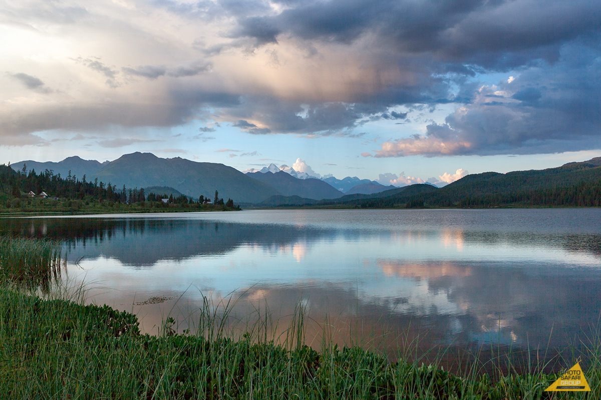
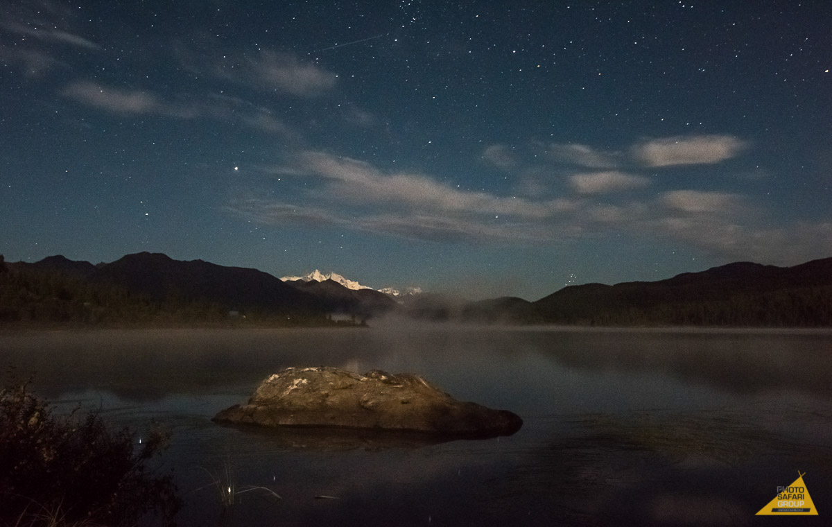
The Yazevoye lake is hiding in the shadow of high cedars, in the heart of Altay of the eastern part of Kazakhstan.
The holy mountain of Beluha is looking into Yazevoye's water from the height of 4,500 meters, and its reflection in the malachite water surface reminds of Roerich's canvases. The artist has dedicated a series of works to Beluha. Locals believe that a wish made during contemplation of the mountain will come true, for sure.
The lake itself is surrounded by tall firs, larches, cedars and Siberian spruces, while its shore is covered with underwood of tender flowers and rare healing herbs. According to local forest rangers, healing seaweeds cover even the very bottom of the lake and therefore the nature here is a true Aesculapius, both for the soul and body.
Как туда добраться:
Озеро Язевое расположено на территории национальной части Катон-Карагай, до которой можно добраться либо на автобусе (каждый день в 8 утра и до 11 часов ночи), либо на такси от автовокзала Усть-Каменогорска. Путь длится девять часов.
Расстояние от поселка Язевое до озера составляет около 30 километров. Чтобы добраться до озера, вы должны пройти по скалистой дороге, которую можно преодолеть только внедорожниками. Вот небольшой рекреационный центр с кабинами для ночлега. Проездные билеты можно получить здесь, а также при предъявлении паспорта и оплаты (0,1 МРП в день).
Вы можете посетить все эти сайты вместе с командой PHOTOSAFARI , которая организует эко-и фото-туры в отдаленные и труднодоступные места Казахстана.